IE OH OHS87/F
·
Item
·
1799
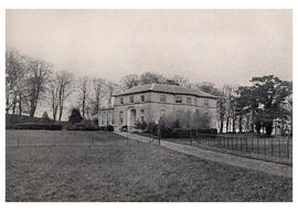
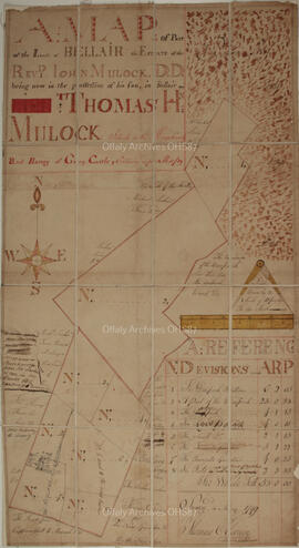
Part of Bellair Estate Papers
Folded map of parts of the lands of Bellair, "the estate of the Reverend John Mulock being now in the possession of his son, in Bellair, Thomas Homan Mulock. Situated in the King's County, and barony of Garrycastle'".
Surveyed in May 1799 by Thomas Cloonin.
Scale of ten perches to an inch.