- IE OH OHS2/DEW
- Sous-fonds
- 1886-2012
Fait partie de Records of the Williams Group
D. E. Williams Ltd.
976 résultats avec objets numériques Afficher les résultats avec des objets numériques
Fait partie de Records of the Williams Group
D. E. Williams Ltd.

Map of the Town of Philipstown, King's County, estate of 4th Viscount Molesworth
Canvas-backed paper map of the former county town of Philipstown (Daingean) compiled by Arthur Richards Neville in June 1786 for Richard Nassau Molesworth, 4th Viscount Molesworth (1748-1793). The map covers 2887 statute acres and includes environs of the town. The plots are numbered 1-130 with an accompanying reference table describing the contents of each land-holding unit. The reference is tabular, listing tenants' name, description of the holdings (e.g. 'a very fine farm all good meadow', 'good high Meadow & Pasture', 'great red bog', 'poor ground' etc) a yearly value and a sum total of the east and south east side of Philipstown.
Scale 20 perch to the inch (1:5040)
Neville, Arthur Richards
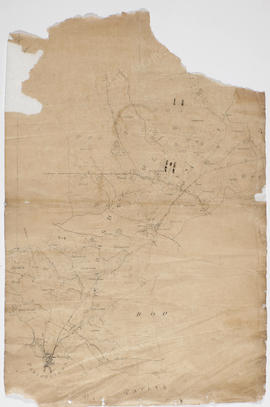
Map of Parsonstown (Birr) area
Fait partie de Sketch maps of William Larkin
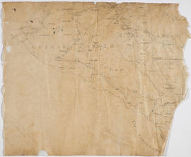
Fait partie de Sketch maps of William Larkin

Fait partie de Sketch maps of William Larkin
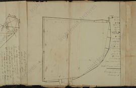
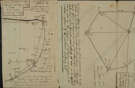
Survey of Tullabeg exclusive of off-set (3)
Fait partie de St Stanislaus College, Tullabeg, Offaly
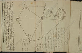
Survey of Tullabeg exclusive of off-set
Fait partie de St Stanislaus College, Tullabeg, Offaly
Survey of Tullabeg exclusive of off-set (2)
Fait partie de St Stanislaus College, Tullabeg, Offaly
Fait partie de Digby Irish Estates

Fait partie de Digby Irish Estates