Identity area
Reference code
IE OH OHS77/6/3/12/1
Title
Page one.
Date(s)
Level of description
Part
Extent and medium
2 photographs
Context area
Name of creator
Repository
Archival history
Content and structure area
Scope and content
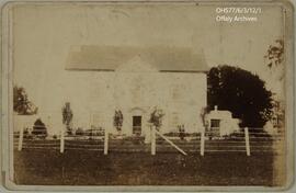
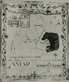
Photograph (top) of a map of the lands of Gurteen, Woodfield, and Ballinamentin, created in 1716 for the Fuller family. The original map remains in possession of the Lamb family. Photograph (bottom) of Woodfield House, taken in the year 1900.
Appraisal, destruction and scheduling
This item is to be retained permanently.
Accruals
System of arrangement
Conditions of access and use area
Conditions governing access
Conditions governing reproduction
Language of material
Script of material
Language and script notes
Physical characteristics and technical requirements
Finding aids
Allied materials area
Existence and location of originals
Existence and location of copies
Related units of description
Notes area
Alternative identifier(s)
Access points
Subject access points
Place access points
Name access points
- Fuller Family (Subject)
- Lamb Family (Subject)
Genre access points
Description control area
Description identifier
Institution identifier
Rules and/or conventions used
Dates of creation revision deletion
Jennifer Lee, September 2018.